Dallas-Fort Worth Metroplex, Texas Vector Map - stock illustration
Poster Style Topographic / Road map of the Dallas - Fort Worth Metropolitan Area, TX, USA. Original map data is open data via © OpenStreetMap contributors

Get this image in a variety of framing options at Photos.com.
PURCHASE A LICENSE
All Royalty-Free licenses include global use rights, comprehensive protection, simple pricing with volume discounts available
kr 2,500.00
NOK
Getty ImagesDallasfort Worth Metroplex Texas Vector Map High-Res Vector Graphic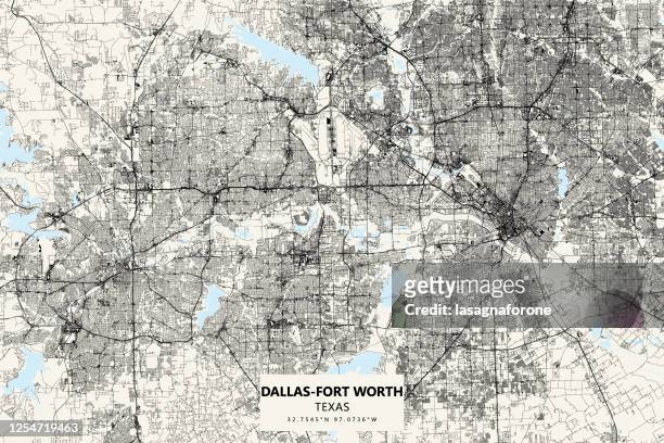 Download premium, authentic Dallas-Fort Worth Metroplex, Texas Vector Map stock illustrations from Getty Images. Explore similar high-resolution stock illustrations in our expansive visual catalogue.Product #:1254719463
Download premium, authentic Dallas-Fort Worth Metroplex, Texas Vector Map stock illustrations from Getty Images. Explore similar high-resolution stock illustrations in our expansive visual catalogue.Product #:1254719463kr2,500kr300
Getty Images
In stockDETAILS
Credit:
Creative #:
1254719463
License type:
Collection:
DigitalVision Vectors
Max file size:
4500 x 3000 px (15.00 x 10.00 in) - 300 dpi - 93 MB
Upload date:
Location:
United States
Release info:
No release required
Categories:
- Map,
- Texas,
- Fort Worth,
- Dallas - Texas,
- Dallas Fort Worth Airport,
- Road Map,
- USA,
- Vector,
- Fort Worth Convention Center,
- Aerial View,
- Airport,
- Architecture,
- Art Museum,
- Blueprint,
- Cartography,
- City,
- City Map,
- City Street,
- Cityscape,
- Cowboy,
- Cowboys Stadium,
- Dallas Convention Center,
- Dealey Plaza,
- Design,
- Direction,
- Downtown District,
- Fort Worth Livestock Exchange,
- Fort Worth Museum of Science and History,
- Fort Worth Stockyards,
- Fort Worth and Western Railroad,
- Geographical Border,
- Global Positioning System,
- Horizontal,
- Illustration,
- Modern Art Museum of Fort Worth,
- Physical Geography,
- Planning,
- Poster,
- Projection Mapping,
- Reunion Tower,
- Road,
- Road Intersection,
- Street,
- Tourism,
- Tourist,
- Travel,
- Travel Destinations,
- Vacations,
- Western USA,
- World Map,