Rand, McNally & Co.'s map of the United States showing, in six degrees the density of population . This map, published in 1892 by the Chicago-based...Rand...
map of the united states of america with states and major cities - united states map major cities stock illustrationsMap of the United States of America with states and major cities
united states major cities map - united states map major cities stock illustrationsUnited States Major Cities Map
north and south korea korean peninsula map - united states map major cities stock illustrationsNorth and South Korea Korean Peninsula Map
map of illinois showing major cities and roads - united states map major cities stock illustrationsMap of Illinois showing major cities and roads
View of a British-produced, World War II-era map of the United States of America showing rivers, major cities, geographical features, and other...US Map Poster
Color illustration showing the time difference between major international cities when it is noon in Washington, DC, 1922.Clocks Of The Principal Cities
This newspaper map from the time of the Cuban Missile Crisis shows the distances from Cuba of various cities on the North American Continent.Distances of Major Cites from Cuba
germany major and state 3d map - united states map major cities stock illustrationsGermany Major and State 3D Map
Millroy's map of Alaska and the Klondyke gold fields, 1897. The Klondike Gold Rush of 1898 began in earnest within 18 months of a major gold strike...Millroys Map Of Alaska And The Klondyke Gold Fields
Los Angeles Fire Department Dispatch Center with electronic maps of the city as well as television station broadcasts on the wall behind the...Los Angeles Fire Department Dispatch Center with electronic maps of the city as well as television
Western motor car route guide, . This automobile guide shows the main highway route between Vancouver, Canada, and San Diego, California, circa 1915....Western Motor Car Route Guide
The Battle of Shiloh, also known as the Battle of Pittsburg Landing, was a major battle in the Western Theater of the American Civil War, fought on...Battle of Shiloh, Tennessee or Pittsburg Landing
Union and Confederate troops in the area surrounding Chancellorsville, Va. At 6 p.m. On May 2, 1863. By late afternoon on May 2, Stonewall Jackson's...Chancellorsville, Va. Position of the 11th Corps at 6 p.m. May 2nd 1863 Major General O.O. Howard commanding.
Seventeen-year-old Josh Lafair speaks during a rally at the Supreme Court during the gerrymandering cases Lamone v. Benisek and Rucho v. Common...Josh Lafair inventor of a Gerrymandering Game
Area surrounding Petersburg on the Appomattox River with all major transportation lines noted. Union forces under Grant are opposed by Lee's...Petersburg Battle Area
Area surrounding Fort Donelson, Tenn. Including the Cumberland River, the town of Dover, and Fort Henry Road, and includes the locations of...Capture of forts Donelson, Tennessee. By U.S. Grant, January 1862.
Fortifications surrounding Richmond including, Brook Run to the north, and Harrison's Landing to the south. The James River and major roads and...Defense of Richmond in 1864
Map shows locations of forces on the second day of battle, before the Confederates broke through the Union line and sent the majority heading back...Battle of Chickamauga
General terrain and disposition of troops around Gettysburg, Pa. As well the fighting northwest of town between the Union's I Corps, under Major...Movements of army from 30th June to 1st July 1863 : and first encounter of 1st Corps with the enemy.
Portions of southern Maryland and northern Virginia emphasizing Winchester, Va. Sneden notes on the map that Winchester was a city that changed hands...Map showing vicinity of Winchester, Virginia, Potomac, etc.
Action of July 1 with most of the major Confederate forces under the command of Stonewall Jackson, D. H. Hill, and Magruder, identified in their...Revised plan of battle of Malvern Hill, July 1st, 1862
Shows the fortifications surrounding Richmond including, Brook Run to the north, and Harrison's Landing to the south. The James River and major roads...Richmond
Bird's-eye view of the city of Pisa on the Arno River, Italy, copper engraving, ca 15x12.5 cm, from Les delices de l'Italie, qui contiennent une...Bird's-eye view of city of Pisa on Arno River, Italy, copper engraving, circa 15x12.5 cm
Bird's-eye view of the city of Pisa on the Arno River, Italy, copper engraving, ca 15x12.5 cm, from Les delices de l'Italie, qui contiennent une...Bird's-eye view of city of Pisa on the Arno River
An aerial view of the urban sprawl in Las Vegas, Nevada, the fastest growing major city in America. The city estimates a new home is completed every...USA - Las Vegas - Aerial View
Army Major Gen. Galen Jackman, commander of the Joint Task Force-Armed Forces Inaugural Committee, talks as he stands on a giant map of the city as...Armed Services Prepare For Inaugural Ceremonies
Army Major Gen. Galen Jackman, the commander of Joint Task Force-Armed Forces Inaugural Committee, talks as he stands on a giant map of the city as...Armed Services Prepare For Inaugural Ceremonies
The map shows the position of the DEW radar line which is being constructed by the United States at a cost of over $1 billion. The line will extend...Map Showing the Positions of a Radar Line
Battle of Travellian Station map - American Civil War. Battle fough as part of Ulysses S. Grant's Overland Campaign against Confederate General...Battle of Travellian Station map - American Civil War
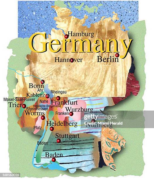
Phillip Brooker color illustration: stylized map of Germany with major cities, wine regions located.Wine
north america major cities map - united states map major cities stock illustrationsNorth America Major Cities Map
Mexico - Cities - Puerto Vallarta ; This is where it all started-Mismaloya. This was the setting for the filming of "The Night of Iguana," and event...APR 9 1972; Mexico - Cities - Puerto Vallarta (Mismaloya); This is where it all started-Mismaloya. T
retro arizona map with major cities - united states map major cities stock illustrationsRetro Arizona Map with major cities
Dr. Shahir Masri, an environmental pollution scientist at the University of California, Irvine shown in his home office in Orange on Thursday, July...UCI Study Shows High Levels Of Lead
Startup6 DATE: CREDIT: Kevin Clark/The Washington Post Washington, DC neg. No. 177971 Matthew Corgan, president and director of technology, John...SLUG: WB-Startup6 DATE: 03.03.2006 CREDIT: Kevin Clark/The Washington Post Washington, DC neg. no. 1
Shoppers look at a map at the King of Prussia mall in King of Prussia, Pennsylvania, U.S., on Saturday, Oct. 20, 2018. Stiffening competition,...Online Brands Coming To A Suburban Mall Near You